|
|
|
|
|
|
|
|
|
 |
|
Nawiliwili Bay once had five streams.
Today, one only flows when it rains, and one has been redirected
through a concrete channel. In this section we will look at
the land that is the source of water for streams, the relationship
between ahupua'a and 'ainakumuwai, and the name and location
of each stream entering Nawiliwili Bay. |
|
|
|
|
|
|
|
|
|
|
Most of the water in
streams comes from the mountains. There, the rainfall either
runs off the land into the stream, or percolates (slowly filters)
through the soil into the groundwater. Groundwater discharge
into the stream is the main source of a stream's flow during
dry periods.(Sugar Water) |
|
|
|
|
|
 |
|
|
|
|
|
|
|
|
|
|
|
|
 |
|
'Ainakumuwai means the land
that is the source of the water, and this is what a watershed
is. The land that drains or percolates its rainfall into a stream
is the watershed, or 'ainakumuwai, for that stream. |
|
|
|
|
|
|
|
|
|
|
An ahupua'a is a Hawaiian land division that runs from the
mountains to the reef. It provided all the materials that
Hawaiians needed to live. Often an ahupua'a might be the watershed
for its stream, although they are not always the same.
To the right is a drawing of an ahupua'a and the resources
that it provided.
Ahupua'a painting by Marilyn Kahalewai
|
|
 |
|
|
|
|
|
|
|
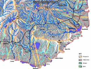 |
A watershed takes its boundaries from the land that drains into
a particular stream, while ahupua'a boundaries divide the resources
among the people. Nawiliwili Bay is unusual, because only two
of its five ahupua'a have boundaries vaguely similar to those
of their stream's watershed. In other moku 'aina, the watersheds
and ahupua'a are more similar. |
|
|
|
Map Courtesy of Ho'okipa Network
Click
to see which ahupua'a boundary matches that of its watershed
|
|
|
|
|
|
|
|
|
|
|
|
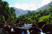
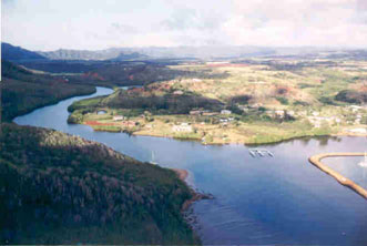
Hule'ia
is the largest stream flowing into Nawiliwili Bay. It travels
through the ahupua'a of Ha'iku and Kipu before it reaches the
small boat harbor. Hule'ia's old name was Hula'ia, which means
pushed through - this meaning is associated with a close encounter
of Pele and Kamapua'a.
(Frederick B. Wichman) |
|
 |
|
|
|
|
|
|
|
|
Photo courtesy of Randy Wichman
|
|
|
|
|
|
|
|
|
|
|
 |
|
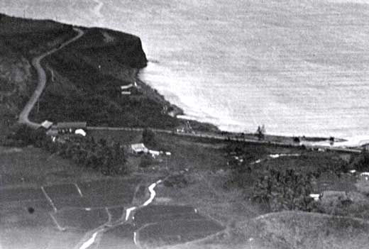
Pu'ali
Stream also enters the bay near the
small boat harbor. Its path is through the ahupua'a of Ha'iku
and Niumalu. While the literal meaning of Pu'ali is tied, this
is said to refer to a warrior's habit of tying his malo
(male's loincloth) at the waist so no flap would dangle for
a foe to seize.
(Frederick B. Wichman) |
|
|
|
|
|
|
|
|
|
|
 |
|
|
|
This is what Pu'ali looked like around 1928.
Notice the agricultural pond fields on both sides.
|
|
|
|
|
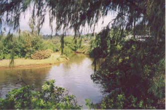
"We use to swim in Pu'ali Stream
by Niumalu bridge....dive off the bridge kind. It had depth,
not now! The water was clean. Right around coral pile was always
clean, could see the crab walking in the net." (Cheryl
Lovell -Obatake) Akoni McGee says he remembers swimming in a
deep and clear Pu'ali Stream as late as the 1980's.
|
|
|
 |
|
Photo courtesy of the Kaua'i Historical
Society
|
|
|
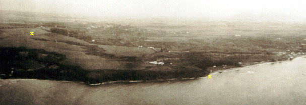
X marks
the beginning and end of the valley cut by Papalinahoa
Stream. The Hale Kauai baseyard now
occupies the area fronting Nawiliwili Bay in this photo When
the jetty was built, Papalinahoa entered the bay beneath the
pier. Papalinahoa no longer
flows all year round - its ground water is tapped by a well,
and its surface water is diverted for use on a golf course.
Papalinahoa Stream traveled along the edge of the ahupua'a of
Nawiliwili. |
|
|
|
|
|
|
|
|
 |
|
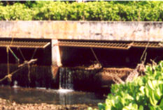
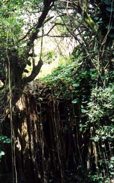
Papalinahoa Waterfall -
kind of dry these days. |
|
|
|
|
|
|
|
|
|
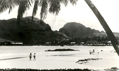
Nawiliwili
Stream enters Kalapaki Bay after flowing through
the ahupua'a of Nawiliwili past the old sugar mill. This is
a popular location for children to swim, although the microorganism
Leptospirosis is always a potential threat to their
health. Nawiliwili was named after the abundant wiliwili
trees in the area. Another meaning of wiliwili is turning in
all directions, and this well describes the stream's meandering
path. |
|
 |
|
|
|
 |
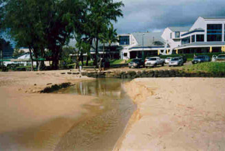
Koenaawanui is the secret stream. It once entered
Kalapaki Bay through the middle of the beach. Now it flows underground
through concrete channels below the hotel. It flowed through
the ahupua'a of Kalapaki. To the left, we can see where Koenaawanui
entered Kalapaki Bay, next to the rock, Mokuweo. |
|
Photo courtesy of Cheryl Lovell-Obatake
|
|
|
|
|
 |
|
|
Photo courtesy of the Kaua'i Historical
Society
|
|
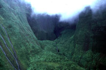
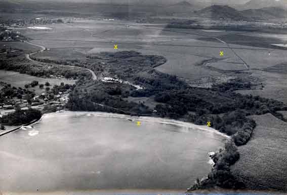
X marks the beginning of the valleys
cut by the two streams of Kalapaki, and their entrance into
the ocean. Koenaawanui is on the left. According to Hobey Goodale,
the stream on the right would flow as long as the cane was irrigated. |
|
|
|
|
|
|
|
|
Nawiliwili has five streams. In a
later section we will examine them as health indicators for
our ahupua'a. Now, let's look at the noted places, or wahi
pana, of Nawiliwili Bay. |
|
|
|
|
|
|
|
|