|
|
|
|
|
| In the ahupua'a system
of land management, the konohiki was responsible for
the sustainability and production of land and water resources
from mauka to makai. In this section, we look
at the new konohiki. Who is responsible for managing
the land and water resources in the ahupua'a of Nawiliwili Bay? |
|
 |
|
Today:
Land uses the General Plan, County of Kaua'i and
The ahupua'a concept: learning coastal resource management
from ancient Hawaiians by M.K. Smith and M. Pai as resources. |
|
|
|
|
|
|
|
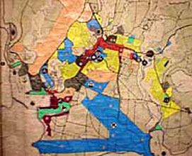
Today there is no clear line of
responsibility for the conservation of land and water resources.
Instead, this responsibility is divided among multiple private,
County, State, and Federal agencies. The boundaries for their
responsibilities do not run from mauka to makai.
For example,, one agency may be in charge of the coastal
zone, one may approve new development, another may be in charge
of water, one in charge of wildlife, etc.. (Smith and Pai) Therefore,
any one agency does not know what is happening in the rest of
the ahupua'a, or in some cases, doesn't care. The head is still
not connected to the tail. |
|
|
|
|
 |
|
At the County level, the Planning Commission decides the
ultimate use of the land. It doesn't matter what the zoning
is, today it takes four votes out of seven to approve a use
permit. Zoning changes depend on a majority of the County
Council.
|
|
|
|
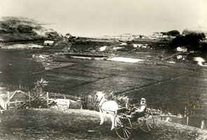
William Hyde Rice, contemplating land use
at Nawiliwili Bay. Photo courtesy of Cheryl Lovell-Obatake,
private collection.
|
|
|
|
|
|
|
|
|
|
|
|
|
|
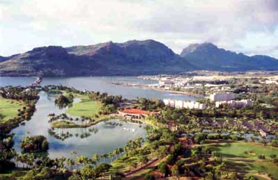
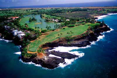
What are some of the current land
uses in the ahupua'a of Nawiliwili Bay? Check out these helicopter
shots, courtesy of pilot Casey Riemer of Jack Harter Helicopters,
and David Boynton, daring photographer.
The first picture, Resort: Hotel
is courtesy of Randy Wichman. |
|
|
|
|
|
|
 |
|
Resort:
Hotels
|
|
|
|
Photo courtesy of Randy Wichman
|
|
|
|
 |
|
|
|
Resort:
Golf Course
|
|
|
|
|
|
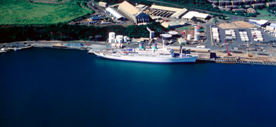
Transportation:
Harbor
|
|
 |
|
|
|
|
|
 |
|
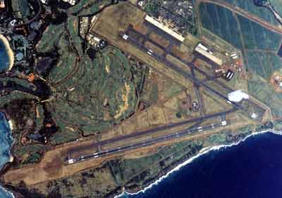
Transportation:
Airport
|
|
|
|
|
 |
|
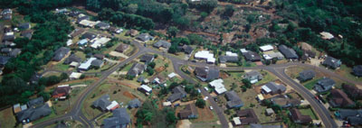
Residential Community
|
|
|
|
|
|
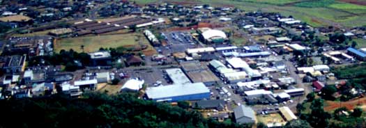
Urban Center
|
|
 |
|
|
|
|
|
 |
|
|
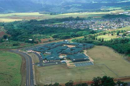
Urban Center: Chiefess
Kamakahelei School
|
|
|
|
 |
|
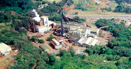
Urban Center:
Power Generation
|
|
|
|
|
 |
|
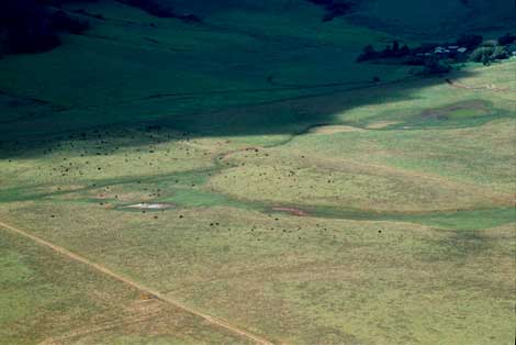
Agriculture:
Ranching
|
|
|
|
|
|
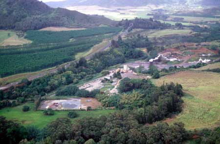
Agriculture:
Tree Farming on the left of the highway
Rock Quarry, with a special use permit, on the
right
Hule'ia Stream flows in
between the two.
|
 |
|
|
|
|
 |
|
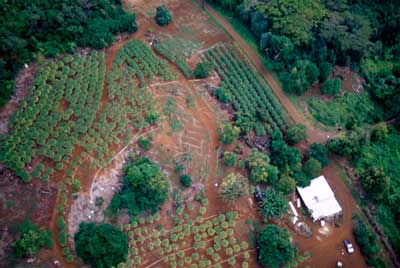
Agriculture: Papayas |
|
|
|
|
|
|
|
|
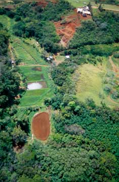
Agriculture: even some
kalo
|
|
 |
|
|
|
|
|
|
|
 |
|
|
Urban Center:
Solid Waste
|
|
|
|
|
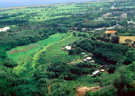
Open:
Wildlife Refuge
|
|
 |
|
|
|
|
|
 |
|
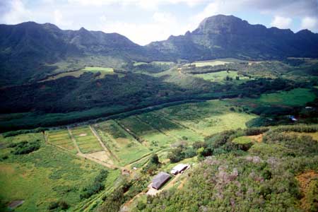
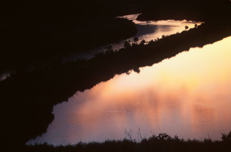
Open:
Nawiliwili Valley
|
|
|
|
|
|
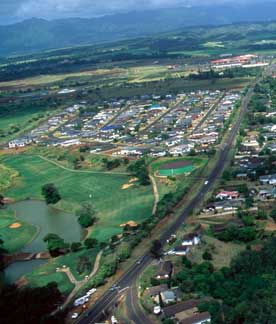
Residential Community:
Golf Course at Ulu Ko
|
|
 |
|
|
|
|
|
|
|
|
|
|
|
|
 |
|
Heritage Resource:
Cultural and Scenic Sites
-
Alekoko Fishpond
|
|
|
|
|
|
|
|
|
Hawai'i now ranks among
the highest in the nation for its levels of pollution, endangered
species, and disappearing habitats. In the next section, we
will take a closer look at the effects of past and current land
use on Nawiliwili Bay. Land, water, and sustainability are all
part of 'Ainakumuwai. |
|
|
|
|
|
|
|