|
|
|
|
|
 |
|
The redesign of Nawiliwili Bay as a harbor was completed in
1930. In this section, we follow the amazing process of turning
Nawilwili Bay into a harbor. |
|
|
|
|
|
|
|
Harbor would
not have been possible without the assistance of Chris Cook
pointing to the photographic resources. |
|
|
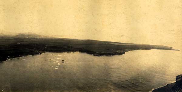 |
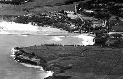
| Nawiliwili Bay in 1905.
X marks the surf spot "ammonias". It was a long left
- before the jetty was built. The shape of the two bays side
by side gave Kalapaki (double yoked egg) its name. |
|
photo courtesy of the Kaua'i Historical
Society
|
|
|
|
|
|
Map of Nawiliwili Harbor made in 1881.
Courtesy Kaua'i Historical Society
|
|
 |
|
|
|
 |
|
|
|
Close up of Kalapaki Bay, with the twin
reefs.
Courtesy Kaua'i Historical Society
|
|
|
|
 |
|
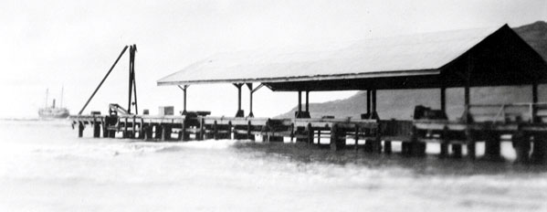
Before the harbor was built, this
was the landing at Nawiliwili. Ships would anchor outside and
the cargo would be offloaded onto smaller boats. It was located
in front of today's Pine Tree Inn. |
|
|
|
 |
|
From this angle we can see Nawiliwili
stream flowing under the bridge. Notice the hillside with no
beach. This is where Duke's restaurant sits today. |
|
|
 |
|
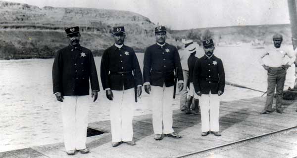
Kaua'i's finest on the landing at Kalapaki
photo courtesy of the Kaua'i Historical Society
|
|
|
|
 |
|
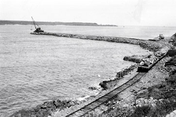
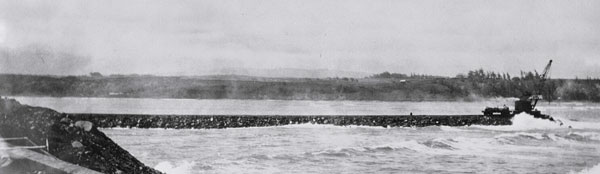
First they built the breakwater.
|
|
|
|
|
|
|
 |
|
Notice the bridge connecting Niumalu
to the Ha'upu side of the bay. Only machines made this breakwater
possible. |
|
|
Hobey speaks about the effects of the breakwater on Kalapaki
Bay: "About 1928, they started building the breakwater.
And when they got the breakwater out, the currents changed and
started to eat away all of the beach. And so my grandfather
had some rock walls built -they came in from the Ninini Point
side stream and then cut all the way across almost to Mokuweo,
just above that where the other stream came in.."
|
|
 |
|
|
No controversy in those
days about the sea walls visible in this old Kalapaki photo's
background. Hobey says these walls are still there, buried by
the sand. |
|
|
|
|
|
|
|
 |
|
Then they built the jetty. Notice how small
the beach was at Kalapaki before the jetty was finished
|
|
|
|
 |
|
photo courtesy of the Kaua'i Historical
Society
|
|
|
| Hobey talks about the
effects of the jetty: "After they finished the breakwater,
where Duke's is today was ocean. The waves were breaking there.
After they finished the jetty, the beach filled up. Little by
little, accretion built up, built up, built up, built up."
In the photo at right, we can see the change in the size of
Kalapaki's beach. When we alter a natural design, there are
always effects. |
|
 |
|
|
|
|
|
|
|
 |
|
They dredged the bottom and used it as fill.
photo courtesy of the Kaua'i Historical Society
|
|
|
|
|
|
 |
|
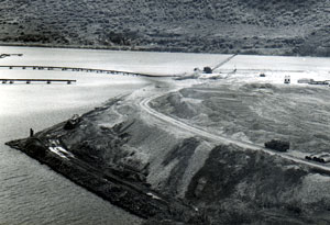
In 1956, this coral promontory (land
that sticks out into a body of water) was built with fill from
the deepened harbor. photo courtesy of the Kaua'i Historical
Society |
|
|
|
|
|
|
 |
|
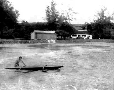
It was new land.
photo courtesy of the Kaua'i Historical Society |
|
|
|
|
|
|
|
|
|
|
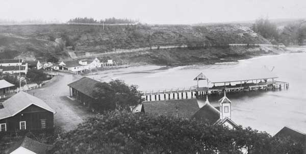
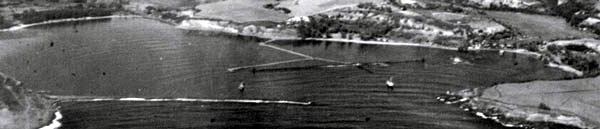
Nawiliwili had a harbor. The small
boat harbor in the above picture was built in 1973, over the
protests of Niumalu residents that it would affect the estuary. |
|
|
|
Cheryl says this about
the effect of the small boat harbor on Niumalu:
" I get kaumaha (depressed) about the Menehune Fishpond
cause building the small boat harbor. I was gone, then I came
back. Dredging the coral pile. I look - plenty tilapia. All
the earthworms came out. Terrible. That stops the flow, the
good flow. That fishpond could be restored, but cause of the
breakwater. The small boat harbor, you look at the white water,
its very shallow - the sediment from the Hule'ia river, can
walk across. Now its really stagnant, not the kind of flow that
should be going into here. Then you have the mangrove, terrible,
collecting sediment." |
|
 |
|
|
Photo by David Boynton, Casey Riemer of
Jack Harter Helicopters, pilot
|
|
|
|
|
|
|
|
|
|
|
|
|
So, Nawiliwili had a harbor. But what about the surf? What about
the fish? In - You like fish?
- two of Nawiliwili's own talk about the ones they caught. |
|
 |
|
|
|
|
photo by David Boynton
|
|
|
|
|
|
|
|
|